Mapmakers merge art and science
 Graduate student Rick Worthington, left, and Cartographic Lab Director Onno Brouwer review a map of Wisconsin bike routes. |
Cartographers have the computer tools today to depict the land in staggering detail, taking inventory of every tree, shrub, bump and crevice. Yet mapmaker Jennifer Grek is inspired less by technology than she is by 400-year-old Dutchmen.
Grek, an employee of the UW–Madison Cartographic Lab, says 17th century Dutch cartographers were revolutionary in their approach to maps, embellishing them with elaborate drawings – called “cartouches” – of mythical figures and strange beasts. The illustrations and icons were meant to convey the soul of the landscape.
“Those maps were incredible, they were so beautifully done,” says Grek. “The Dutch didn’t see a difference between art and science in a map. They looked at maps and landscape paintings in the same way.”
Grek is doing her master’s thesis on Dutch cartography, and the old-school lessons serve her well at the cartography lab. The oldest facility of its kind associated with a university, the lab specializes in maps that are not just accurate, but also visually intriguing, artistically rendered and user-friendly.
Tucked away on the third floor of Science Hall, the lab attracts an amazing variety of projects. As expected, they create lots of maps for scholarly books and research publications. But they also make maps for the National Park Service, Wisconsin Department of Tourism and private recreation groups.
If you want to find the best bicycle and snowmobile routes across the state, maps from the lab will get you there. Ditto if you are hiking interstate routes such as the North Country Trail, Ice Age Trail or Lewis and Clark Trail (more than 600,000 of those three maps are in circulation).
Special-order maps will guide you through the Colorado mountains and 10th Mountain Division Hut Association, showing the way by hoof to Uncle Bud’s Hut or the Polar Star Inn. Or you can view a lavishly detailed map of the UW–Madison Arboretum, pointing the way through Evjue Pines or the Lost City Forest.
The common denominator, says lab Director Onno Brouwer, is bringing a combination of art and science to their work. It’s a mix that’s sorely needed in the field today, he adds.
Map-making science is booming: Technology such as geographic information systems (GIS) has revolutionized mapmaking by providing incredibly detailed databases of land features. But the art of presentation hasn’t caught up with the technology, he says.
The lab was established in 1953 by acclaimed geographer Arthur Robinson, known for developing a flat world map with realistic dimensions that is the most frequently used world map available. Brouwer says Robinson looked at all components of making effective maps. “His research quantified how people look at maps, how people read maps, and how they view color, type, layout and symbols. It was all brought on by Robinson and his generation of cartographers.”
Brouwer says the lab still carries on that tradition, although it became a somewhat lost art with the rise of GIS and mapping software, which allow virtually anyone with a computer to make maps. Problem was, Brouwer says, publishers and scientists ended up with either attractive maps with suspect geography or data-rich maps too esoteric or dull to understand. Brouwer is seeing a reversal now, with publishers seeking both the eye and intellectual rigor of cartographers.
The lab’s proudest achievement is the Cultural Map of Wisconsin, a unique graphical account of the state’s cultural legacy that has now sold more than 20,000 copies, Brouwer says. He is also fond of a new McGraw Hill atlas of African-American history for which the lab produced nearly 150 maps. And a current mapping project for the book “Buildings of Wisconsin” will highlight famous landmarks and architectural influences across the state.
Brouwer sets high standards for the maps created in the lab, which makes a job there a second education for his all-student staff. It’s a connection to the classical work in the field and the chance to be both a physical and cultural geographer.
“Every map has a story and every story should have a map,” Brouwer says. “Look at history books. It’s extremely difficult to tell some stories in words, such as the story of U.S. migration. If you want people to visualize it, a map is the best approach.
“We like to think we can tell a story even better than the written word.”
One map on the lab’s wall tells a story of amazing persistence. It’s a three-by-five foot topographical map of Wisconsin, 30 years old, intricately drawn by hand with a charcoal pencil. Rich Worthington, a geography doctoral student, shows – for the sake of contrast – the modern GIS counterpart. On his computer screen, a small region of southern Wisconsin literally explodes with detailed contours and lines.
Ironically, the hand-drawn map is more useful to Worthington for making maps for public consumption. To him, a good map unfolds in a series of visual layers that guide but don’t overwhelm the reader.
“Too much information is a problem with most maps today,” he says. “Part of the art of cartography is abstraction.”
Tags: research
-
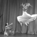
Dancing for (over) a century
The Dance Department is preparing to celebrate the centennial of UW–Madison's (and the nation's) first dance major. Look back at some of the milestones that have shaped the program.
-
The Badger starter pack
From chamber music to the chemistry lab, these five UW intro courses see the highest enrollment — and set students up for long-term success.
-
How to win a Nobel Prize
Meet the UW–Madison faculty and alumni whose discoveries changed the world.
-
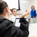
Teaching students to deliberate, not debate
In a public policy course, UW–Madison students put the science behind productive disagreement into practice.